In this article:
What changed: The city dashboard shows 250 road monitoring stations and water accumulation categories of 5–10 cm and over 10 cm; the official map offers sensors and cameras. In the following October report, authorities said conditions had improved: there was no severe flooding on main roads, while moderate flooding persisted on Luang Phaeng and Chalong Krung.Updated: October 27, 2026
What changed: In the October 7 report, authorities advised avoiding sections of Chalong Krung, Suwinthawong and Latkrabang roads. The flood map shows photos, times and addresses of reports and lets you filter them by district or time.Updated: October 6, 2026
What changed: Added information about the free flood map: detours around flooded sections, parking, temporary shelters and English-language support. The time of the September PRD report was clarified: 08.30. September measurements are marked as historical data.
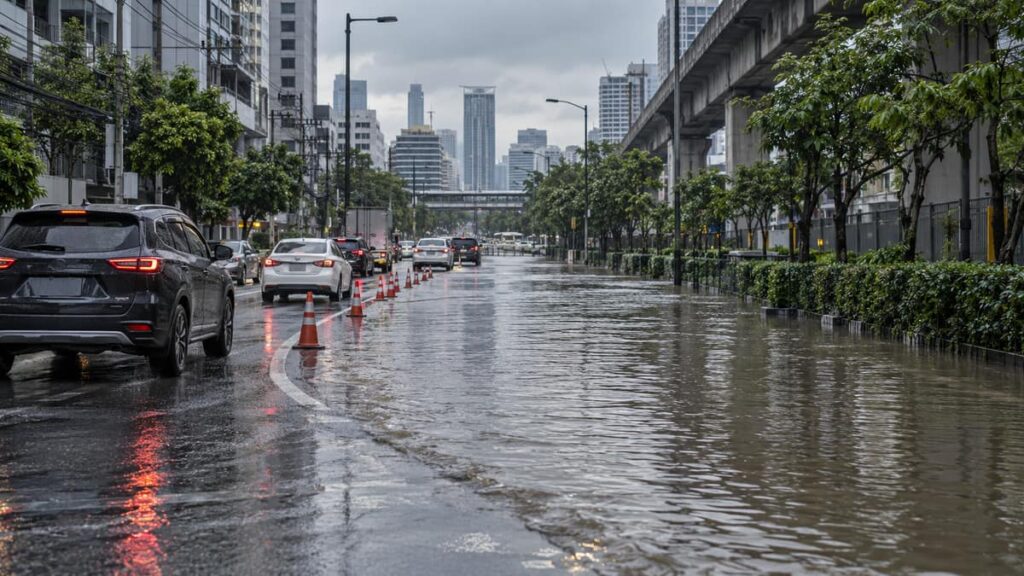
Bangkok roads are better checked after heavy rain using city sensors and flood reports, rather than old lists of closures. Current as of November 13, 2026. The city dashboard shows water depth categories, and the observation log shows the time and condition of the measuring posts. This helps assess the situation before a trip, but does not replace checking a specific stretch of road.
The September and October warnings from authorities are useful as a historical reference: they show where difficulties have already arisen, but do not confirm current restrictions. The Chulalongkorn University map can be used to find a possible detour by comparing its information with city monitoring. For general trip preparation, the article on road safety in Thailand. The key is to distinguish the publication date of an old report from the time of the sensor’s last measurement: these are different indicators, and neither one alone guarantees safe passage.
What Is Known About Flooding and City Sensors
According to data as of November 2026, on the official dashboard of the Bangkok Drainage Department when viewed, it listed 250 stations of water measurements on the road surface. This refers to the number of observation posts, not the number of flooded streets. The dashboard sorts water accumulation into categories of 5–10 cm and over 10 cm; a sensor reading does not mean that driving on the road is allowed.
The dashboard also showed the rainfall accumulation period from 07:00 on November 12 to 07:00 on November 13, 2026. This is the rain measurement period, not the validity period of a road closure warning. During a one-time check, the number of districts with marked flooding was 0, but such a dynamic indicator cannot be taken as confirmation that every street is dry.
Bangkok Roads: Sections from the September and October Reports
The September warning from Thailand’s Public Relations Department is dated September 27, 2026, 08:30: the agency suggested checking a list of 31 routes, which at the time were advised to be avoided. This is an archived list, not a list of roads closed on November 13.
In the government statement of October 7, 2026 (12:51) individual problem sections were identified:
- Chalong Krung near the King Mongkut’s Institute of Technology in Latkrabang;
- Suwinthawong near the Muang Min intersection;
- Latkrabang at the Chorakhe Noi intersection.
In a separate government explanation it was noted that water on sections of five roads did not mean that all these roads were closed along their full length. For a separate stretch of Bangkok-Kritha, depths of 20–30 cm. Later, the government reported an improvement in conditions: severe flooding of main roads was no longer observed, while moderate flooding persisted at points on Luang Phaeng and Chalong Krung. Both reports describe the past situation, not current measurements.
The following map landmarks are kept to help locate places from the earlier material:
- Eleventh Infantry Regiment Gate Two
- Kasetsart University
- Ramintra Soi Five
- Phahonyothin Road
- Sripatum University
- Phahonyothin Soi Fifty One
- Fala Sin Road
- Prasertmanukit Road
- Phahonyothin Soi Fifty Five
These markers are landmarks on the map, not active flood reports. They show neither the current water depth nor whether the road is passable.
Official Flood Map: Sensors and Cameras
In the city’s road sensor table, the road, station, date and time of observation, water level and record status are given. Official Bangkok Monitoring Map additionally shows water measurement points in tunnels and a layer of video surveillance cameras. It is more practical to check a specific stretch of road with this data than to judge the situation by the total number of marked districts.
Check not only the figure but also the time of measurement. For example, in the sensor register the post on Phahonyothin Road at the Kaset intersection was marked as faulty, and its record was dated July 16, 2026 (2569 by the Thai calendar). A zero or outdated reading from a faulty post does not prove that the road is free of water.
Chulalongkorn University Map (Tuammai)
In a Chulalongkorn University post dated October 2, 2026 (2569 by the Thai calendar), the Tuammai map is described. According to the university, it shows photos of road conditions, suggests a route around flooded sections, and marks free parking and nearby shelters.
The university reported that free access to the map opened September 27, 2026 (2569 by the Thai calendar). Availability of features and terms of use may have changed later. Even if the service offers a detour, this is not yet confirmation that it is passable; a parking or shelter marker also does not mean there are free spaces there now.
What to Do
Before your trip, check road conditions step by step:
- Open the city dashboard and see whether flooding is marked near your route.
- Compare the information with the road sensor table: pay attention to the update time, water depth and station status.
- Check the official sensor and camera map, then compare the observations with your chosen road and a possible detour.
- If the information is insufficient or the section is covered with water, do not rely on an outdated record and do not drive through the water.
For trips to the airport, Thailand’s Tourism Authority recommended checking the route in advance and leaving extra time for the trip. The same September message mentioned a tourist hotline 1672; it is best to check its availability before calling. If your plans change, see transport options in Bangkok and the general overview of what the weather is like in Thailand: they do not confirm that a specific route is operating during flooding.
Sensor readings, traffic restrictions and service availability may change. Just before leaving, check the stretch you need against official monitoring again, especially if the road passes through places that appeared in archived reports.
Prepared by MyThai.online editorial team.